

Public access
Newport Fishing Pier
What to notice
Walk the municipal pier for ocean views or fish in the designated area; walking is free, while fishing rules and fees can apply.
Learn moreInformation from: City of Sunny Isles Beach
Area guide · Miami-Dade
A vertical oceanfront market between the Atlantic and the Intracoastal, with meaningful differences in building age, services, exposure and carrying costs.
The area in context
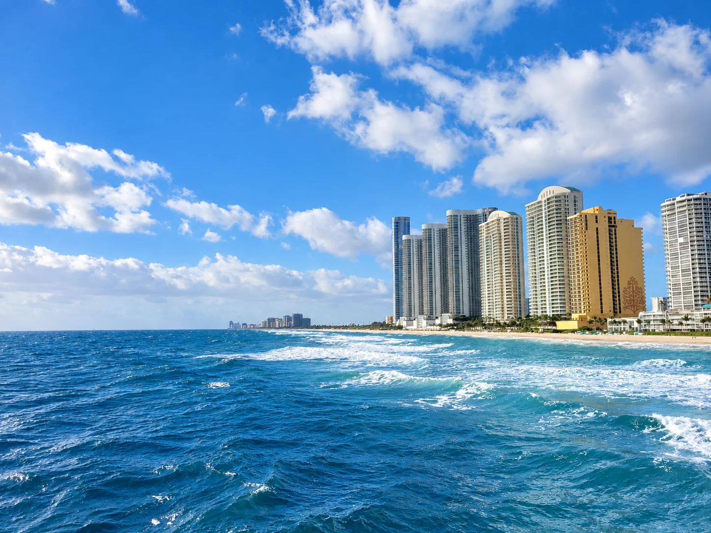
Sunny Isles Beach evolved from the motels built along Collins Avenue in the 1950s and 1960s, once known as Motel Row, into a skyline of oceanfront high-rises. Collins Avenue forms the central spine, with condominium towers facing either the Atlantic or the Intracoastal and lower-scale residential streets toward the north and west.
The public beach, Newport Fishing Pier, parks and the Collins Avenue dining corridor create a clear sequence of local landmarks. Porsche Design Tower's vehicle elevators and in-unit garages illustrate how specific towers differ; Residences by Armani/Casa and Turnberry Ocean Club are other oceanfront references. For real estate, construction cycle, reserves, services, exposure, insurance profile and recurring costs can vary substantially even within the same block; building and residence details require direct verification.
The former Motel Row included Miami Modern (MiMo) motels from the 1950s and 1960s. Sunny Isles now draws one of Greater Miami's most international buyer bases, contributing to a multicultural daily life and multilingual local businesses.
Area guide
The best way to understand the area is to move through it with attention: notice how the landscape changes, how the architecture meets the street and how parks, culture and transportation connect each stop.
A walk from the Newport Fishing Pier through Samson Oceanfront Park makes Sunny Isles Beach's central contrast visible: a continuous public shoreline sits beside a vertical residential corridor. Collins Avenue carries the commercial and transportation spine, while the Intracoastal defines the western edge. Comparing both sides of the city reveals why ocean exposure, floor height, view corridors, building age and access to the beach can produce very different property profiles within a narrow geography.
Start at the Newport Fishing Pier to see the city's narrow geography at once: Atlantic to the east, Collins Avenue through the center and the Intracoastal to the west. Continue along the public beach accesses and Samson Oceanfront Park, then move north toward Heritage Park to compare the oceanfront tower corridor with the smaller civic spaces behind it.
Newport Fishing Pier • Samson Oceanfront Park • Heritage Park
Plan the visit in sections: these landmarks do not necessarily form one continuous walk. Check travel between them on a map and confirm transport, parking and access hours before setting out.
What to notice
Walk the municipal pier for ocean views or fish in the designated area; walking is free, while fishing rules and fees can apply.
Learn moreInformation from: City of Sunny Isles Beach
What to notice
Use this oceanfront park for beach access and city programming, checking the municipal calendar for current events and operating details.
Learn moreInformation from: City of Sunny Isles Beach
What to notice
Explore a neighborhood-scale park on the north side of the city and compare its quieter setting with the oceanfront corridor.
Learn moreInformation from: City of Sunny Isles Beach
Current residential listings for sale matching the search below, from the MIAMI Association of REALTORS® MLS, delivered through Bridge.
Feed search scope: City field: Sunny Isles Beach. This is a feed field match.
View listingsActive listings matching this search
1,180
Lowest current asking price
$75,000
Highest current asking price
$47,500,000
Average current asking price
$1,791,811
Median current asking price
$705,000
Average asking price per sq ft
$789 / sq ft
Range based on the lowest and highest asking prices among 1180 active residential listings matching the displayed feed query. These are current asking prices, not closed-sale values, and may include atypical properties. Updates are checked every 12 hours. The feed may report photos even when their URLs are unavailable. This is not a boundary-based census.
Based on information from the MLS of MIAMI Association of REALTORS® as of October 17, 2026.
A realistic comparison depends on the purchase price range, the area and the property's exact position within it. Waterfront exposure, the building or association and even adjacent streets can place two properties in different competitive sets.
Talk with Flavia about this marketReading the area
In a coastal condominium market, exposure, view corridors, reserves, insurance profile and building condition can matter as much as the address.
Access, hours, fees and programming can change. Use the linked source before planning a visit.
Price range, area and exact location change the comparison. Talk with Flavia to identify the submarkets and properties that fit your purchase plan.
Schedule a consultation