

Public access
Miami Beachwalk
What to notice
Walk or cycle the oceanfront route that connects South, Mid and North Beach, using it as a practical way to compare the city's different stretches.
Learn moreInformation from: City of Miami Beach
Area guide · Miami-Dade
A barrier-island city where oceanfront condominiums, historic districts and distinct north-to-south submarkets require a building-by-building comparison.
The area in context
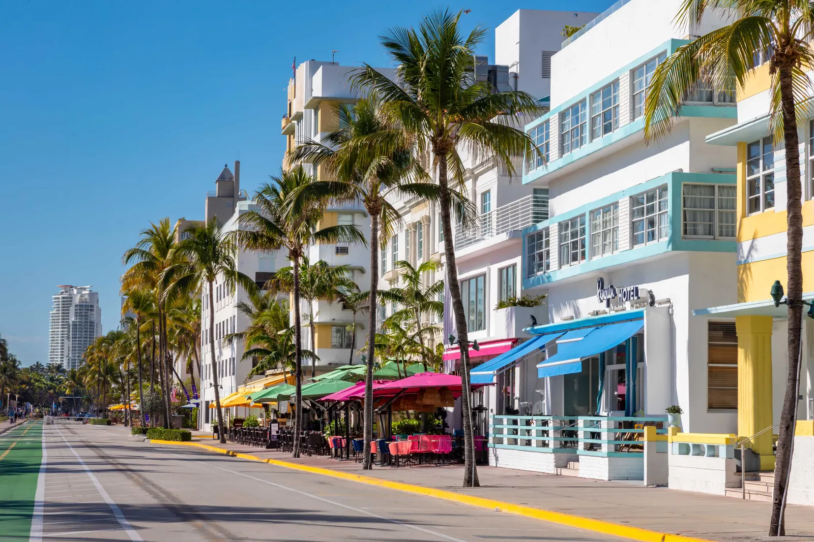
Miami Beach is an independent city set on a barrier island, not a neighborhood of the City of Miami. Its built history ranges from the Art Deco and Mediterranean Revival fabric of South Beach to postwar buildings in Mid-Beach and a more varied residential scale in North Beach. Sunset Harbour, La Gorce Island and Normandy Isle add distinct settings that should not be treated as one market. The Art Deco district entered the National Register of Historic Places in 1979, and the Miami Design Preservation League offers guided architecture walks.
The Beachwalk links long stretches of the oceanfront, while Lincoln Road, cultural institutions, parks and established dining corridors shape daily movement away from the sand. The city has road-elevation and stormwater-pump projects, and Ocean Drive has a sidewalk and lighting improvement plan; project status and flood exposure must still be checked by location. The real estate mix includes historic low-rise properties, mid-century buildings and contemporary towers, making age, reserves, exposure and renovation history central to comparison.
Within that broader map, Sunset Harbour has become a notably walkable pocket of boutique restaurants and fitness studios. The Art Deco Historic District is actively protected by its preservation community. The city's substantial investment in elevated roads and stormwater pumps signals a long-term commitment to the barrier island's value, while Ocean Drive's revitalization aims to improve the dining and hospitality experience.
Area guide
The best way to understand the area is to move through it with attention: notice how the landscape changes, how the architecture meets the street and how parks, culture and transportation connect each stop.
To understand Miami Beach beyond a single postcard, follow the city from south to north. Ocean Drive introduces the Art Deco façades and the relationship between architecture and the beach; Lincoln Road adds a pedestrian commercial axis; the Beachwalk then connects different building eras, parks and stretches of shoreline. The municipal trolley makes it possible to compare these districts without treating the entire barrier island as one uniform market.
Treat the island as three different chapters. South Beach concentrates the historic fabric and the liveliest pedestrian circuit; Mid-Beach introduces the postwar resort scale; North Beach opens into a calmer sequence of parks and lower-rise blocks. The Beachwalk connects the coastline, while the trolley helps bridge distances that are longer than the map suggests.
South Pointe Park • Ocean Drive • Lincoln Road • North Beach Oceanside Park
Plan the visit in sections: these landmarks do not necessarily form one continuous walk. Check travel between them on a map and confirm transport, parking and access hours before setting out.
What to notice
Walk or cycle the oceanfront route that connects South, Mid and North Beach, using it as a practical way to compare the city's different stretches.
Learn moreInformation from: City of Miami Beach
What to notice
Explore the historic district's architecture and public realm before extending the route to Ocean Drive and nearby cultural venues.
Learn moreInformation from: Greater Miami Convention & Visitors Bureau
What to notice
Combine a beach day with municipal parks and the free trolley network; routes and service notices should be checked before departure.
Learn moreInformation from: City of Miami Beach
Current residential listings for sale matching the search below, from the MIAMI Association of REALTORS® MLS, delivered through Bridge.
Feed search scope: City field: Miami Beach. This is a feed field match.
View listingsActive listings matching this search
2,096
Lowest current asking price
$95,000
Highest current asking price
$110,000,000
Average current asking price
$2,574,909
Median current asking price
$649,000
Average asking price per sq ft
$1,086 / sq ft
Range based on the lowest and highest asking prices among 2096 active residential listings matching the displayed feed query. These are current asking prices, not closed-sale values, and may include atypical properties. Updates are checked every 12 hours. The feed may report photos even when their URLs are unavailable. This is not a boundary-based census.
Based on information from the MLS of MIAMI Association of REALTORS® as of October 17, 2026.
A realistic comparison depends on the purchase price range, the area and the property's exact position within it. Waterfront exposure, the building or association and even adjacent streets can place two properties in different competitive sets.
Talk with Flavia about this marketReading the area
In a coastal condominium market, exposure, view corridors, reserves, insurance profile and building condition can matter as much as the address.
Access, hours, fees and programming can change. Use the linked source before planning a visit.
Price range, area and exact location change the comparison. Talk with Flavia to identify the submarkets and properties that fit your purchase plan.
Schedule a consultation