

Public access
Bayfront Park
What to notice
Walk the 32-acre waterfront park for bay views, open lawns, the fountain and public events in the civic core.
Learn moreInformation from: Bayfront Park Management Trust
Area guide · Miami-Dade
Miami's civic and bayfront center, combining established towers, a substantial new-development pipeline, transit and major cultural venues.
The area in context
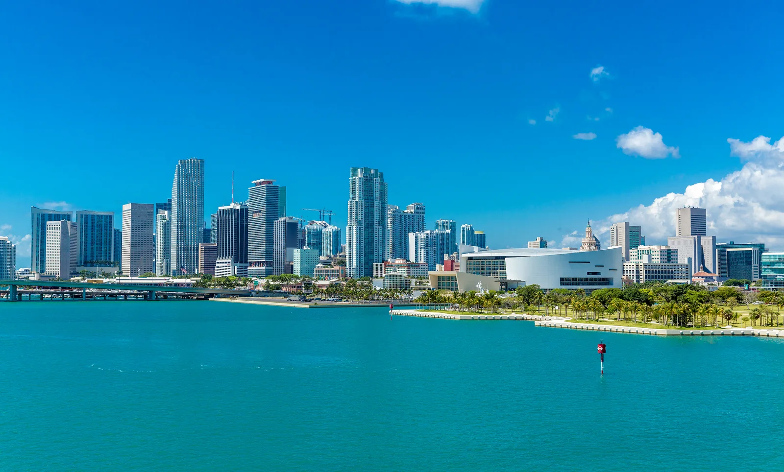
Downtown Miami developed around the Miami River, Biscayne Bay and Flagler Street, named for the railroad builder Henry Flagler and historically the city's main commercial street. The city’s planning documents still identify working waterfront and shipping uses along the Miami River, separate from PortMiami’s cargo terminals. The area layers historic civic and commercial buildings with office towers and established condominiums. Miami Worldcenter redeveloped a 27-acre area across several downtown blocks, illustrating the scale of recent mixed-use construction.
Bayfront Park and Maurice A. Ferré Park open the district to the water. Freedom Tower, Olympia Theater and the Alfred I. duPont Building are surviving historic landmarks, while Kaseya Center hosts the Miami Heat on the bayfront. Museums, performance venues and Metromover connect cultural and transportation networks. Brightline's MiamiCentral station links Downtown with Fort Lauderdale, West Palm Beach and Orlando. Block-by-block conditions vary; building age, construction nearby, transit access, operating costs and the relationship to the river or bay are more informative than a single district-wide label.
Flagler Street dates to Miami's 1896 founding, when Henry Flagler's railroad helped create the modern city. Miami Worldcenter is among the largest urban redevelopment projects in the United States. The working Miami River carries cargo bound for the Caribbean and Latin America, while Kaseya Center sits on the bayfront just north of Bayfront Park.
Area guide
The best way to understand the area is to move through it with attention: notice how the landscape changes, how the architecture meets the street and how parks, culture and transportation connect each stop.
Downtown Miami rewards a route that alternates between the bay and the transit grid. Bayfront Park and the waterfront introduce the civic shoreline; Maurice A. Ferré Park brings major museums and open space; Metromover links those anchors to Government Center, older commercial blocks and Miami Worldcenter. The changing streetscape reveals several markets at once, from established towers to new mixed-use delivery, each with a different relationship to transit, public space and future supply.
Alternate between waterfront and transit. Bayfront Park introduces the civic edge of Biscayne Bay; Maurice A. Ferré Park links open space with PAMM and Frost Science; Metromover carries the route inland through older commercial blocks, Government Center and newer tower clusters. The elevated ride is also a useful viewpoint for understanding how quickly Downtown changes from one stop to the next.
Bayfront Park • Maurice A. Ferré Park • Pérez Art Museum Miami • Government Center · Metromover
Plan the visit in sections: these landmarks do not necessarily form one continuous walk. Check travel between them on a map and confirm transport, parking and access hours before setting out.
What to notice
Walk the 32-acre waterfront park for bay views, open lawns, the fountain and public events in the civic core.
Learn moreInformation from: Bayfront Park Management Trust
What to notice
Use the northern waterfront park to connect with Pérez Art Museum Miami and Frost Science, checking museum admission and hours separately.
Learn moreInformation from: Bayfront Park Management Trust
What to notice
Use the fare-free Metromover to connect the waterfront, Government Center and Brickell while reading Downtown's tower clusters at street level.
Learn moreInformation from: Miami-Dade County Transit
Current residential listings for sale matching the search below, from the MIAMI Association of REALTORS® MLS, delivered through Bridge.
Feed search scope: Text search: Downtown Miami. Matches listing fields; not an official neighborhood boundary.
View listingsActive listings matching this search
59
Lowest current asking price
$240,000
Highest current asking price
$3,075,000
Average current asking price
$437,578
Median current asking price
$350,000
Average asking price per sq ft
$460 / sq ft
Range based on the lowest and highest asking prices among 59 active residential listings matching the displayed feed query. These are current asking prices, not closed-sale values, and may include atypical properties. Updates are checked every 12 hours. The feed may report photos even when their URLs are unavailable. This is not a boundary-based census.
Based on information from the MLS of MIAMI Association of REALTORS® as of October 17, 2026.
A realistic comparison depends on the purchase price range, the area and the property's exact position within it. Waterfront exposure, the building or association and even adjacent streets can place two properties in different competitive sets.
Talk with Flavia about this marketReading the area
In a vertical urban district, compare the individual building, its delivery or renovation cycle, operating costs, transit access and the supply arriving nearby.
Access, hours, fees and programming can change. Use the linked source before planning a visit.
Price range, area and exact location change the comparison. Talk with Flavia to identify the submarkets and properties that fit your purchase plan.
Schedule a consultation